
Wenhaston
Archive Project |


 |
||
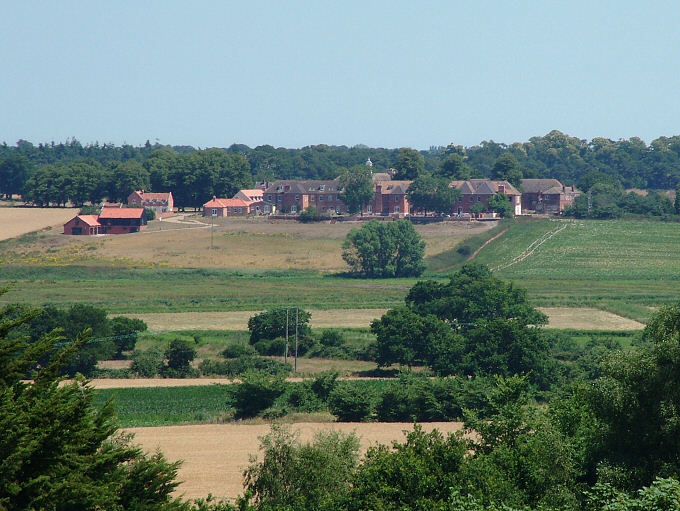
| On the northern side of the Blyth valley we zoom in on the housing complex 'Blythview' created from what was the Union Workhouse at Bulcamp. Originally built in 1766 this is now designated a Grade II historic building. There is a self-catering apartment here, 'Highsteppers', for holiday let, sleeping four and with use of the shared gym and indoor swimming pool in the grounds. Click the link shown on the left of Wenhaston's village map (also shown on Blythburgh's village map on www.blythburgh.net). It is believed that this site, or very close to it, is one of Suffolk's oldest battlefields. In 654AD, the army of King Anna, Christian King of the Angles, led by the King and his son, were being chased by King Penda, pagan King of Mercia, with his army. Here King Anna stood his ground and suffered defeat; both he and his son were slain amid much carnage and post-battle pillaging. | ||
| [Previous Photo] [Next Photo] |
| Blythweb | Blythburgh | Bramfield | Halesworth | Southwold | Walberswick | Wangford